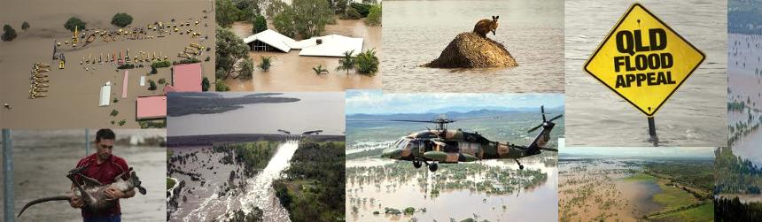
Queensland Floods
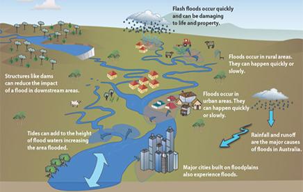 Illustration of factors contributing to floods | Occurrence: • January 10: Flash flooding occurred in Toowoomba which flooded Lockyer Valley and and killed around a dozen people. • The Brisbane River reached its peak on January 10. • January 13 the Brisbane river reached it's peak, but 20,00 housed were already inundated. What it was:
Resulting Damage: • Evacuation of thousands of people. Areas affected: Majority of central and southern Queensland, including Brisbane, Rockhampton, Emerald, Bundaburg, Dalby, Toowoomba and Ipswich. |
Causes:
The floods
were a result of heavy monsoon rains caused by Tropical Cyclone Tasha
that combined with a trough during the peak of a La Niña event.
The rare storm and hilly landscape contributed to the flash flooding in Toowoomba. Because the soil could not not absorb all the moisture from Queenslands recent storms, the water turned into a runoff predominately into the Murray Darling and Murphy's Creek.
This water flowed into the Lockyer Creek continuing down Grantham and Gatton flooding all cities located near them.
Lockyer Creek is directly linked with the Brisbane River but also flows into Ipswich
200mm of rain also fell on Lockyer Valley, heightening the situation.
Weather Pattern associated with flood:
Peak of La Nina event, strongest since 1973
Prolonged event of monsoonal heavy rainfall – result of Tropical Cyclone Tasha.
Normal Weather pattern:
Climate: Humid, warm, subtropical climate are normal conditions expected in Queensland. Because of it's geographical size it's temperatue varies vastly across the state. High rainfall is also, warm summers and mild winters.
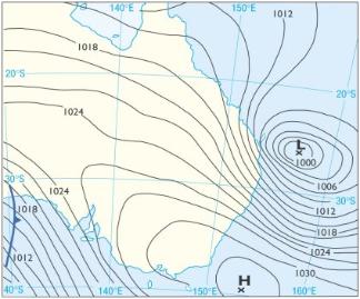 Synoptic chart, December 2010 Low pressure system moving into Queensland, this contributes to the heavy rainfall and strong winds. | 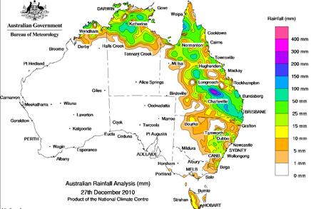 Chart of rainfall around Queensland |